Tropical Cyclone Narelle Crosses Australia
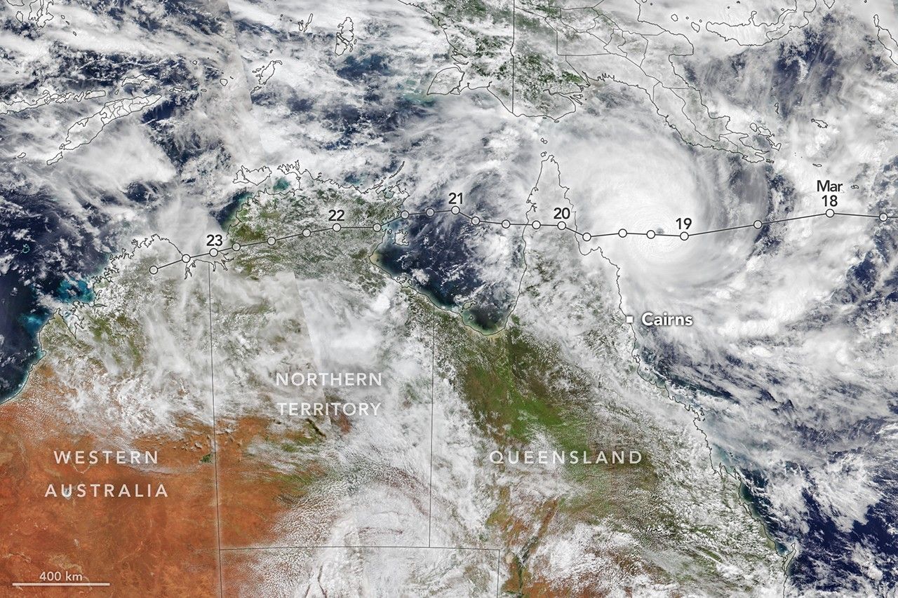
Tropical Cyclone Narelle tracked across the northern edge of Australia in late March 2026 as a powerful storm system that made multiple landfalls between March 20 and March 23, 2026, bringing destructive winds and heavy rainfall to Queensland, the Northern Territory and parts of Western Australia. Satellite data from NASA’s NOAA‑21 VIIRS instrument captured the cyclone as it approached the northeastern Queensland coast with a defined eye and extensive convective cloud bands indicative of a mature tropical system. The system’s prolonged interaction with the continent’s topography and saturated ground conditions contributed to flash flooding and widespread precipitation across regions that were already wet from earlier rainfall events.
Narelle intensified substantially over the Coral Sea, reaching Australia’s tropical cyclone peak classification equivalent to sustained winds near 225 kilometers per hour, roughly comparable to a major hurricane intensity on the Saffir‑Simpson scale. NASA Earth Observatory imagery shows the storm’s spiral bands and dense central core of deep convection associated with strong wind fields and heavy precipitation for communities along its path. Ocean surface temperatures along the cyclone’s track were observed to be 0.5 to 1.0 degrees Celsius above average, a factor that can enhance tropical cyclone energy and rainfall potential due to greater heat and moisture availability in the lower atmosphere.
The path taken by Narelle across northern Australia was notable for its longevity and multiple impacts in distinct geographic regions. After initial landfall in Queensland, the system maintained organized structure as it crossed inland into the Northern Territory before emerging over the Indian Ocean, where forecasts suggest potential restrengthening. Such long‑lived tropical cyclones illustrate the complex interactions between large‑scale oceanographic conditions and regional atmospheric circulation patterns that shape extreme weather events in the Australian cyclone region. Continued satellite monitoring by NASA Earth science missions supports situational awareness of storm structure and precipitation fields, which inform meteorological agencies and emergency managers about ongoing weather hazard evolution.